What is new for uDig 1.2
- Terradata
- Spatial Toolbox
- Generic DataStore
- Improved Tools for working with Raster Data
- Additional Export wizards
- Additional Import wizards
- New Style Editor Pages
- Additional Raster Formats
- Tile Server Support
- WFS 1.1.0 Support
- Experimental Tiled Renderer
- ArcSDE
- Advanced Symbology
- Framework Improvements
Spatial Toolbox
Spatial toolbox has arrived allowing access to a vast range of spatial functionality provided by through Open Modeling Services 3 components.
For more information:
- Introduction to the Spatial Toolbox covers the installation and use of JGrass compoenents
- Spatial Toolbox view
Generic DataStore
The GeoTools library provides access to more data formats than we have created customer wizards for. In the interests of encourage adopting and testing of new technologies we have created a “generic” GeoTools DataStore wizard allowing you to try out ... everything.
Improved Tools for working with Raster Data
A couple of tools have been added for working with raster data:
- Info Tool is now able to work with raster data
- Profile Tool
Additional Export wizards
The Export Wizard allows you to export new kinds of information from the uDig catalog for use in other applications.
- Export coverage to tiff or esri ascii
- Export feature layer to kml
These are export wizards available from the File ‣ Export menu.
Additional Import wizards
The Import Wizard allows you to import new kinds of information into the uDig catalog for use.
- Allows the easy creation of an image moasic from a directory of images
- Import CSV files directly
- Convert a KML file to a Shapefile
These are import wizards available from the File ‣ Import menu.
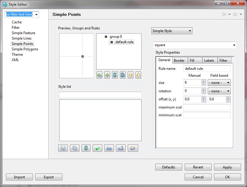
New Style Editor Pages
A great series of new style editor pages has been created showcasing the power of the rendering engine.
Additional Raster Formats
A great improvement is the ability to work with additional raster formats, and working with images larger then memory.
- GeoTiff
- World Image (JPEG, GIF, PNG, etc...)
On select platforms:
- ECW
- MrSID
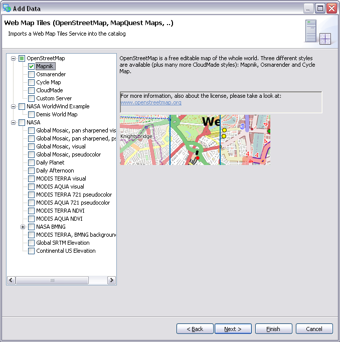
Tile Server Support
This release provides support for Web Map Server Caching (WMS-C) allowing access to tile servers such as GeoWebCache and TileCache.
WFS 1.1.0 Support
Thanks to OpenGeo for implementing WFS 1.1.0 support. You can now specifiy WFS=1.1.0 in your capabilities connection URL to work with servers supporting this standard.
This feature does not support WFS-T at this time.
Experimental Tiled Renderer
You can turn on Tiled rendering (as an option in preferences). When combined with the new flicker free panning tool results in a nice sliding map experience.
ArcSDE
The ArcSDE support has been rewritten from the ground up in collaboration between OpenGeo and Refractions. The new implementation is threaded allowing for a responsive user interface experience.
Advanced Symbology
The rendering system has received a great many enhancements:
- Advanced Symbology including Hatches and True Type Font support
- Style Layer Descriptor document no longer includes defaults resulting in a smaller file
Advanced “Vendor Specific Options”:
- Text to flow along a line
- Geometry functions
Framework Improvements
For the developer community using uDig as a platform for custom applications:
- We have migrated to a modern version of the GeoTools library - bringing in five years of new developments in standard support, and a host of new raster and vector formats.
- Addition ImageIO-ext project allowing the use of raster formats supported by GDAL.